 |
| RH Bonnycastle |
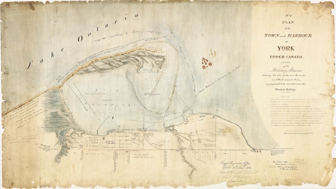
Several plans made in the 1830s, including this one, were oriented to the south, probably under the influence of military map-makers whose attention was always focused on the harbour and its defense.’
- Isobel Ganton & Joan Winearls, MAPPING TORONTO'S FIRST CENTURY 1787-1884
Click the image to view a full-size version (PDF).
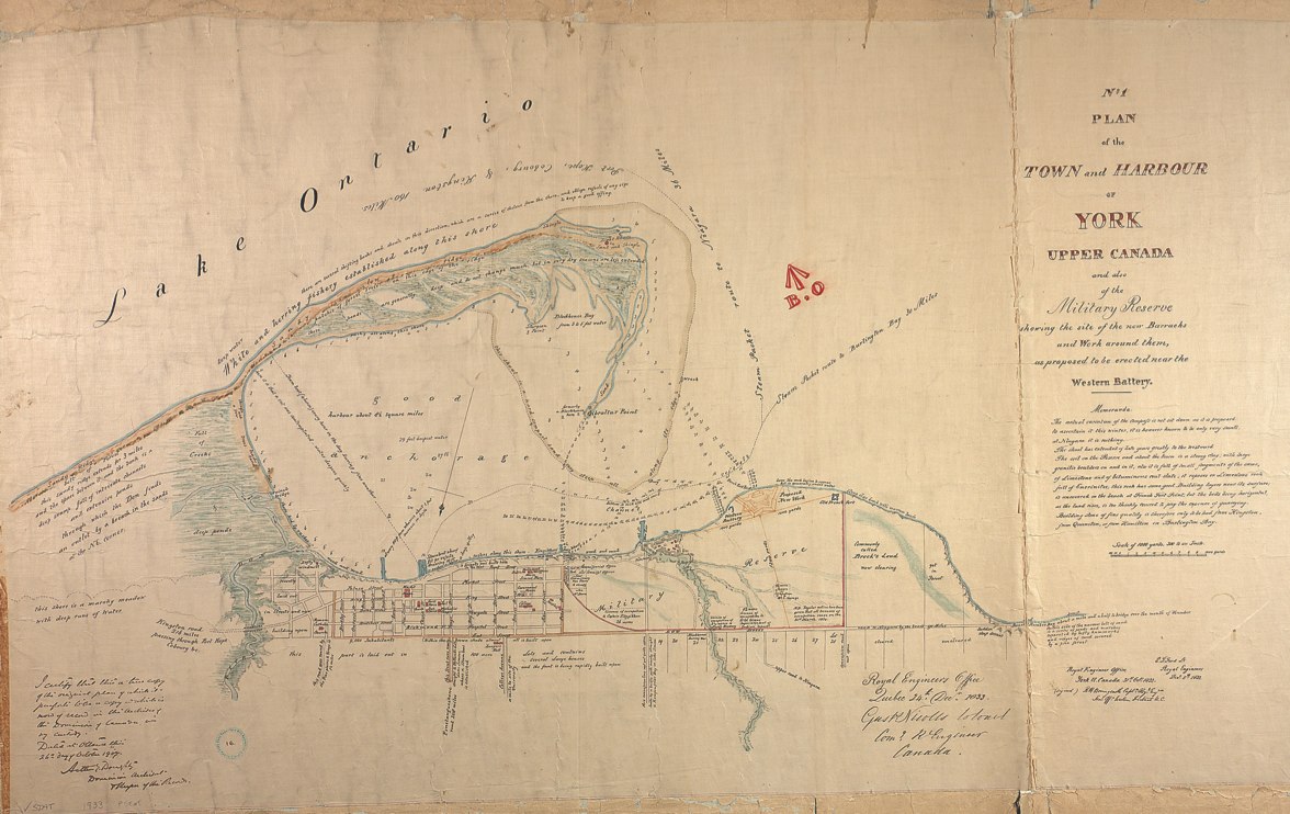
No. 1 plan of the town and harbour of York Upper Canada and also of the Military Reserves showing the site of the new barracks and work around them, as proposed to be erected near the Western Battery.
Royal Engineer Office York U. Canada 31st Octr 1833 (Signed) RH Bonnycastle Captn Royl Engrs Senr Off. Western District U.C. E.J. Ford Lt Royal Engineers Decr 5th 1833 Gusts Nicolls Colonel Comg R Engineer Canada.
Image courtesy Library and Archives Canada: NMC 16818. Winearls, MUC no. 2063 (2)
‘Sir Richard Henry Bonnycastle (1791-1847) was the son of a professor of mathematics at the Royal Military Academy. He was in command of the Royal Engineers in Upper Canada at Kingston from 1837 to 1839 and was knighted for his services during the Rebellion. He was the author of several books about Canada and an amateur painter. [Bonnycastle was also the father of Henry William John Bonnycastle, who drew a related map in 1834. -N.]’
- Ganton/Winearls, ibid
This next version is a copy submitted to Ottawa in 1907.
Click the image to view a full-size version.
 |
| Lt.-Col. Gustavus Nicolls |
Image courtesy TPL: T1833/4Mlrg.
Lieutenant-Colonel Gustavus Nicolls commanded the Corps of Royal Engineers in Canada from 1815 to 1837, and was responsible for the 1816 Nicolls & Duberger Plan of the Fort at York Upper Canada.
Please ‘Like’ and Share these maps with other Toronto history enthusiasts! (+1s are also welcome!)


0 comments:
Post a Comment